
Kayaking to Lummi Island
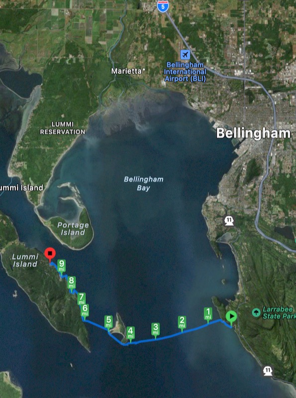
2023 Jul 28I did an overnight kayak trip to Lummi Island from Larabee State Park. It started with a 4 mile crossing. Crossings like this are not trivial because of the exposure they can present to the effects of bad weather, however, the day was calm and pleasant.
Along Lummi I found colonies of healthy sea stars (mostly 10 inch purples) and they were dense enough that sometimes they were even on top of each other. There were more there than I had seen in years, and this was very encouraging.
Lummi has one camping place, but it is accessible only by boat. It is off a lovely cove and the camp sites have wonderful views of the territory.
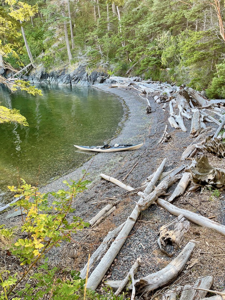
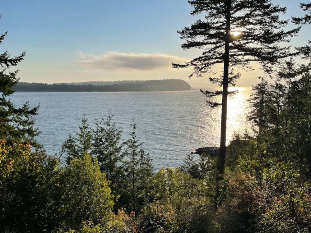
However, I stayed at a friend's cabin on the island. This was my view in the morning.
The next day had more adventure. There was a steady 10 mi/hr northerly wind all day. It gave extra speed in the crossing to Portage Island's isthmus, but it took speed away the rest of the day. I was concerned the land crossing might be a slog of soft mud. Instead, it was a rocky surface that some people were even driving on. So, it was only a short walk with the boat on my shoulder.
My plan was to follow the shoreline while crossing Bellingham Bay, however, the water there was too shallow. The entire time crossing the bay I could have bumped my paddle on the bottom. The water was barely deep enough.
The wind coming up the channel and into the bay had built the water into rollers. The shallowness of the bay then amplified their height so they often became breaking waves. At one time this would have been a challenging kayaking situation for me, however, I have learned paddle skills such that my travel stayed relaxed though slowed slightly.
When I got into Bellingham I passed through the marina. What a difference! Suddenly flat water and no wind. At the other side though, a guy entering by power boat shouted, "Are your muscles ready?". He was right. The wind and waves were concentrated there and sometimes the water flew into my face. I had to pull right into it, but again, because of improved techniques although it was work it was not strenuous.
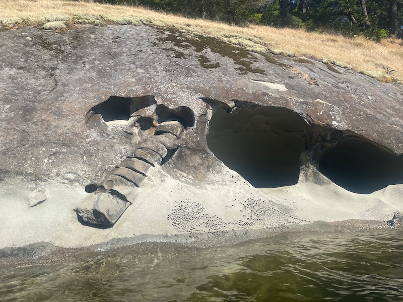
Chuckanut Bay (mi 17) was very interesting. Much of the edge is sandstone that has microorganisms growing on its surface, hardening it unevenly. This causes very strange erosion patterns of swirls and scooped cavities. The forms become fantastical looking.
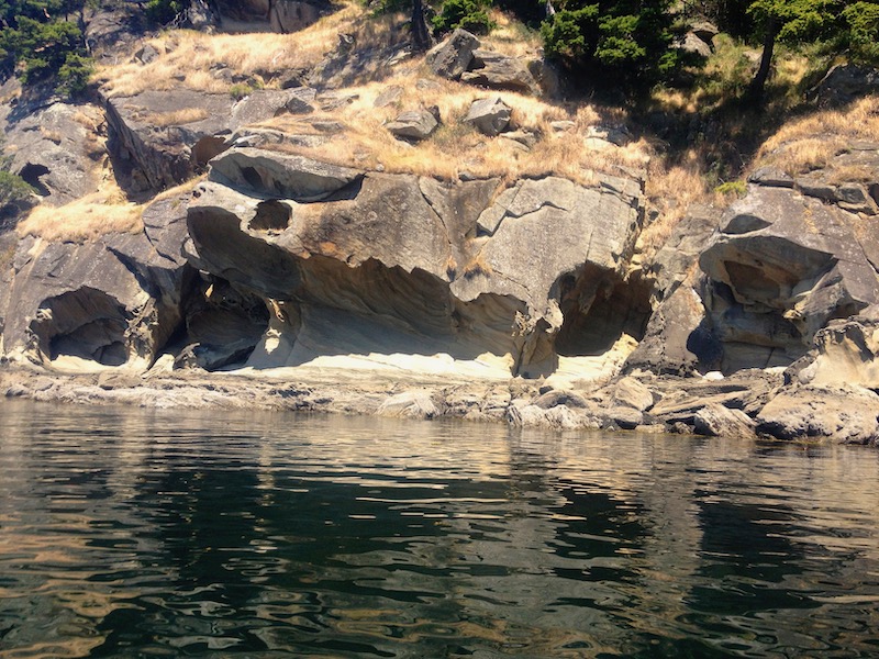
There was even something that looked like fossilization. I heard it described like a dinosaur backbone, but my actual guess it is a mineralized palm tree trunk. There were several of these exposed.
At the end I could have kayaked farther, but I was also ready to stop. Thankfully, the body was tired but it was not sore.
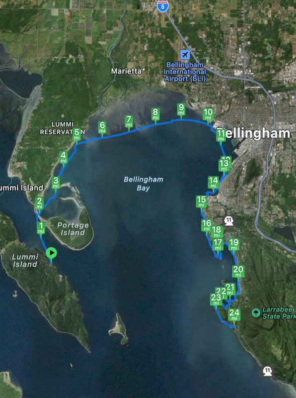
Larabee State Park is on scenic Chuckanut Drive. On the return drive I stopped at one of the view pull-outs and looked back at the islands.
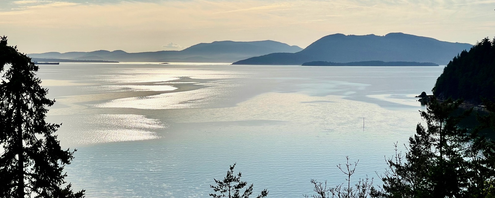
Lummi is the visually highest peak at right. The lower island in front of it is the one I passed at mile 4 on day 1. The (actually higher) peak at center is Mt. Constitution on Orcas Island.
It was a great trip.